Washington Post mapmaker shares cartography skills with WJ students
Video by Julia Hananel
Oct 11, 2019
AP Human Geography students got to hear from award-winning cartographer Laris Karklis last Thursday, who created the famous interactive map “Borderline” that provides a unique way of looking at the U.S.-Mexico border. “Borderline” allows viewers to explore locations on the border from a bird’s-eye view and learn about the people living there.
Karklis talked with students about why maps play an essential role in journalism and storytelling.
“Every news story has a ‘where’ factor to it, and that’s generally the first question that can be answered in a news story,” Karklis said.
Students learned about unconventional ways that maps can be used to convey information — Karklis has used dots to map terrorist attacks, he’s used colors to depict climate conditions, and many more creative tactics.
“We had looked at one of his maps and we realized we had a wonderful opportunity to have him over and tell us how he makes these maps,” Human Geography teacher Liliana Monk said.
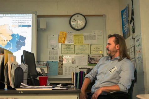
Washington Post cartographer Laris Karklis shares his award-winning “Borderline” map with WJ students. Karklis visited the AP Human Geography classes last Thursday.


